Climate & Sustainability
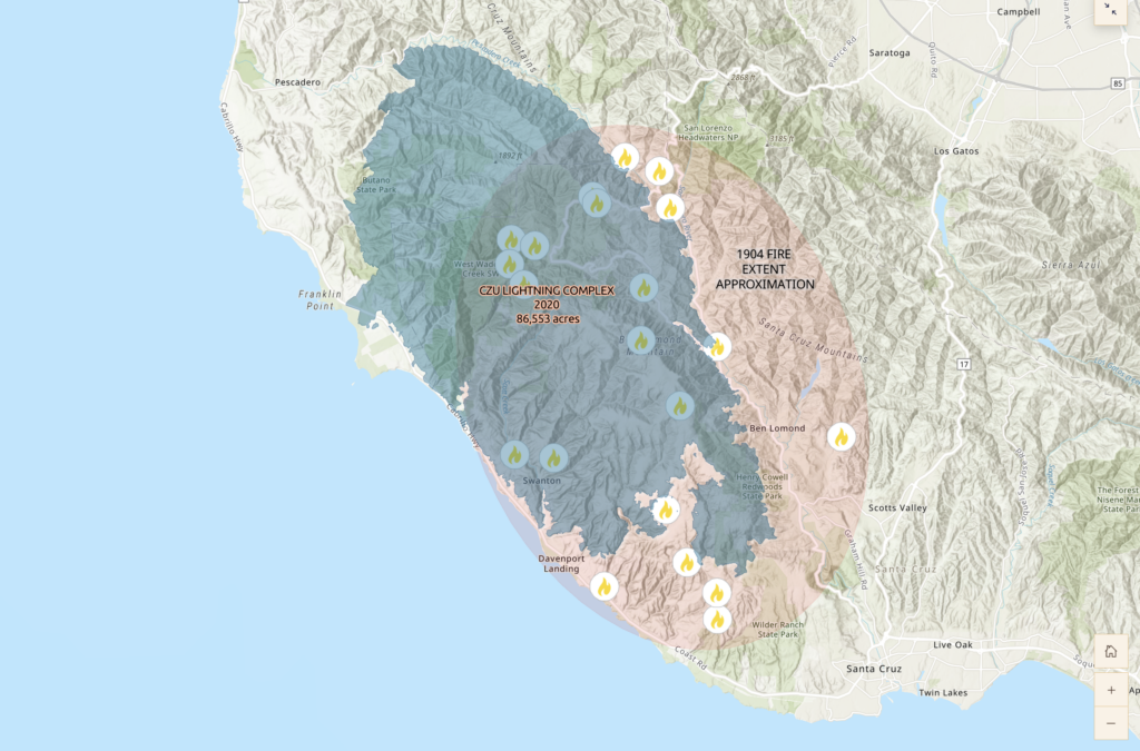
Story maps show massive fires like CZU are not a new phenomenon for Santa Cruz
An anthropology project traces the history of land use and fire in the county, revealing lessons for future management and mitigation
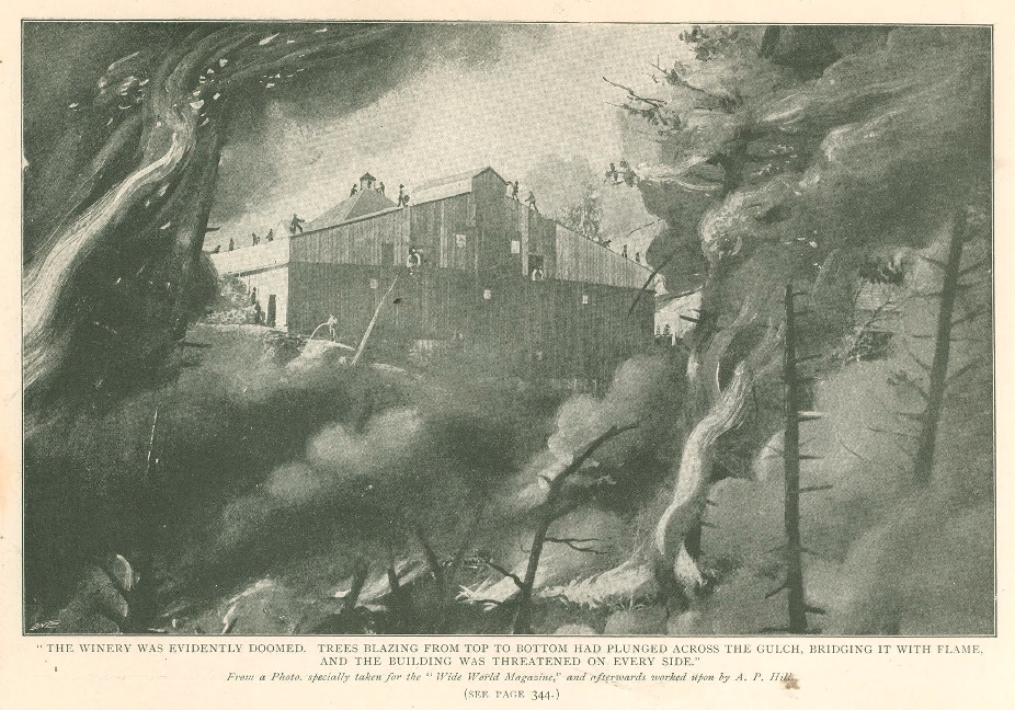
Fire threatened the Meyers Mar Vista Winery in Santa Cruz, as featured in Wide World Magazine. The use of wine as fire retardant ultimately saved the building.
Press Contact
When the CZU Lightning Complex fire devastated large swaths of Santa Cruz in 2020, the natural environment and the lives of those living in the affected area were deeply changed. But new research shows this life-changing event was not the first of its kind for Santa Cruz County.
A series of story maps, produced by an interdisciplinary team led by University of California, Santa Cruz Professor of Anthropology Andrew Mathews, traces the history of fire and land use change in the region from the 19th century to the present, and finds evidence of very large fires in the early 20th century.
The maps are part of a broader project led by Professor of Sociology Miriam Greenberg to understand the Wildland Urban Interface (WUI). Called “WUI Research for Resilience,” this initiative studies the deep history of the contemporary growth of population and housing in the WUI, which is currently both the fastest growing and most fire-prone land use type in the United States.
The authors hope the project empowers people in Santa Cruz and beyond to engage with the history of the region and consider how housing and land-use practices can be altered to prevent climate disasters.
“Climate change can sometimes feel like this new, exceptional thing that’s happening out of nowhere, especially when you think about the devastating fires that have happened along the Central California coast over the last few years, and for many other parts of the world,” said Kathryn Gougelet, an anthropology Ph.D. candidate who was a primary author on the story maps. “But I think one of the big findings for this project is that these big fires are actually happening because of really particular decisions that have been made about how to manage landscapes on the Central Californian Coast over time.”
Mapping fire
This project, titled “Fire, Plants, and People in the Santa Cruz Mountains: How Climate Change Activates History and New Relationships with the Land,” is the result of collaboration between faculty, graduate, and undergraduate researchers at UC Santa Cruz and San José State University.
The project includes three story maps with interactive features for exploring the locations of historical fires in Santa Cruz, as well as historical and present-day photos, archival materials, and illustrations.
The first, focused on the history of the region, shows how the forested region was shaped by cattle ranching, logging, and agriculture. The Indigenous Awaswas-speaking Uypi peoples long stewarded their Indigenous homeland, known as Popeloutchom, until much of the land was forcefully taken by Spanish colonists and converted into pastures. Later, the logging industry began to extract timber and change the land. Today, this land is cared for by the Amah Mutsun Tribal Band.
“What some people might think of as this beautiful, relatively pristine forest actually was heavily logged and burned in from the late 19th to mid-20th century,” Mathews said.
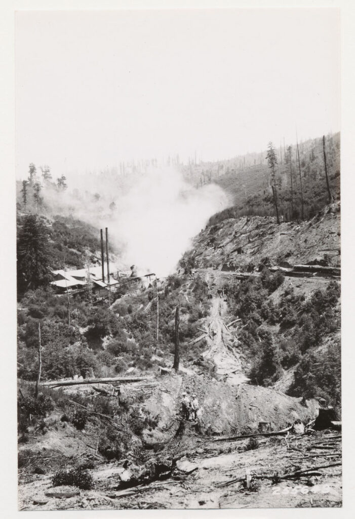
The story maps show how these practices contributed to several massive wildfires more than 100 years ago that burned footprints similar to that of the 2020 catastrophe. San José State University Professor of Environmental Studies Dustin Mulvaney and SJSU graduate student David Vasquez Ospina analyzed newspaper archives detailing the locations of historical fires, which they transposed onto contemporary maps of Santa Cruz.
The work demonstrates how over time, some of these lands remained pastures while others were converted into orchards, and much of the present-day housing is built on former pastures and orchards, contributing to climate risks. UC Santa Cruz undergraduate students Griffin Svec-Burdick and Nathan Leroy, under the direction of Assistant Professor of Environmental Studies Bo Yang, converted historical, aerial view photographs of the region to make composite maps of the area in the 1930s. This enabled comparisons of the past and present-day landscapes.
“A lot of the recent development that happened in the WUI actually happened in those old orchards, and something about orchards made it feel like a really stable landscape,” Gougelet said. “This helped people kind of forget that fire was a really crucial part of those landscapes before.”
A second story map, called “People Responding to Fire,” explores how people in the region are maintaining and developing new relationships with the land in the years since the CZU fires. In interviews with community members including prescribed burners, Cal Fire managers, county officials, and Indigenous people caring for the land, the piece chronicles the grief and loss in the wake of the destructive fires. But it also shows the new relationships that people are creating with the land through day-to-day maintenance and collective community actions for fire prevention. Anthropology Ph.D. candidate Emily Chambers led efforts to conduct these interviews in conjunction with undergraduate and graduate researchers in the groups of Greenberg and Associate Professor of Sociology Hillary Angelo.
“Climate change is really cueing us to pay closer attention to the histories that got us here, and the ways that we need to live in these landscapes to be ready for the next fires. It’s demanding that we be in better relationships with the land, and a lot of that is coming from Indigenous cultural burning practices that were in better relationship with the land before settlers came and dispossessed people from the coast, and that are ongoing through more recent cultural burning efforts led by the Amah Mutsun Tribal Band, including on the Quiroste Valley Cultural Preserve,” Gougelet said.
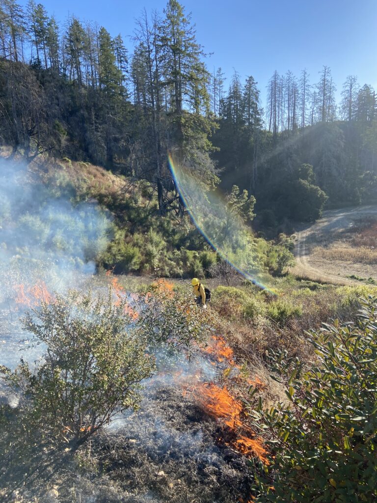
A controlled burn at Molino Creek. Photos by Emily Chambers.
The third story map, called “Plants Responding to Fire,” aims to give people tools to recognize how plants in the Santa Cruz landscape are adapted to fire and record its history.
“Most of the time, fire is not there, but it leaves physical traces in plant form, in charred tree stumps, in areas of scrub or pine,” Mathews said. “When people think fire is an abnormal presence here, that’s kind of true, but it’s also an important presence, and it’s a landscape which has been dealing with fire for a long time.”
The story maps were produced with support from the Center for Critical Urban and Environmental Studies (CUES), UC Santa Cruz Center for Coastal Climate Resilience (CCCR) grant “Designing Just and Fire Resilient Landscapes in California,” and University of California Climate Action Seed Grant “Wildland Urban Interface Research for Resilience: Addressing California’s Climate, Conservation & Housing Crises” led by Professor of Sociology Miriam Greenberg. Raty Syka, a lecturer in the UCSC Art department, contributed artwork and design.