Climate & Sustainability
New air quality sensors enable community decision-making in Pajaro Valley region
Newly deployed sensors will fill in significant gaps in the area’s air quality monitoring network
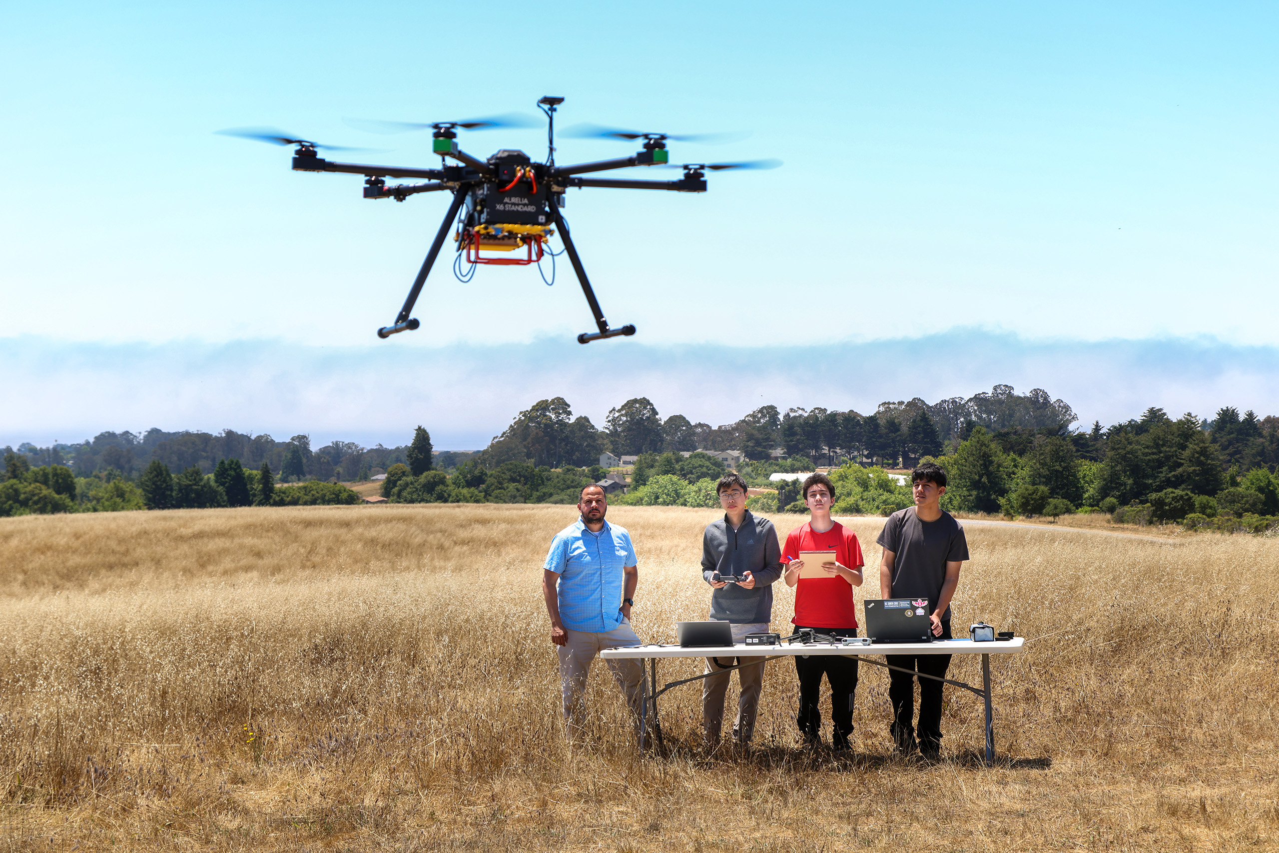
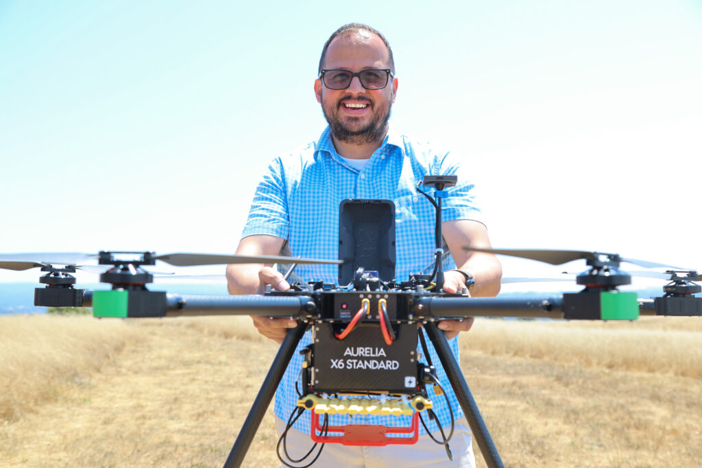
Assistant Professor of Applied Mathematics Javier González-Rocha with UC Santa Cruz undergraduate Andy Wu and high school students Sina Ghelichkhani and Gerardo Rosas-González.
Photos by Carolyn Lagattuta
Press Contact
Key takeaways
- Newly deployed sensors will fill in significant gaps in the air quality monitoring network in the Pajaro Valley region.
- In an area home to many people who work outside in agricultural jobs, the initiative aims to empower community decision-making for those most affected by pollutants like wildfire smoke.
- The research team is exploring novel methods to make air quality data accessible to affected communities, and combine sensor information with data from drones to better model and predict pollution levels.
Newly installed air quality sensors near schools in the North Monterey County and Pajaro Valley Unified School Districts display color-coded lights, reflecting current air quality conditions. In the event of wildfire smoke or other pollution events, these easily visible signals provide community members, school staff, and local organizations with real-time information to help protect health and make informed decisions about outdoor activities.
These new sensors are actively being deployed as part of a project to improve air-quality monitoring in the Pajaro Valley led by University of California, Santa Cruz Assistant Professor of Applied Mathematics Javier González-Rocha in partnership with Watsonville-based climate justice organization Regeneración.
The initiative will empower people in the region, which includes underserved farmworking communities, to make informed decisions about their health in response to the compounding effects of wildfire smoke and other air pollutants. In an area where many people work outside, data has shown extended periods of unhealthy air after wildfires, with levels nearly ten times the federal threshold after the 2020 CZU Lightning Complex Fire.
The project is supported by a $100,000 grant from the UC Santa Cruz Center for Coastal Climate Resilience, and González-Rocha hopes to use the insights from these efforts to further expand air quality monitoring and modeling in the Pajaro Valley and throughout the state. Along with installing new sensors, the researchers are taking drone surveys of air quality, which will fill in significant gaps in the air quality monitoring network in Pajaro Valley and beyond.
“We’re invested in the community, and we’re excited about developing these partnerships that can have a direct impact in the region,” said González-Rocha, who is also a Climate Justice Fellow with the UC Santa Cruz Center for Reimagining Leadership.
Filling data gaps
González-Rocha began using drones to study air quality and the compounding effects of wildfire smoke and air pollutants in pollution-burdened agricultural communities in California, with a focus on the Central Valley, as a Chancellor’s Postdoctoral Fellow at UC Riverside. When he joined the Baskin School of Engineering faculty at UC Santa Cruz in 2023, he began focusing his expertise at disparities in Watsonville—the community where he grew up—and the surrounding Pajaro Valley region.
Using publicly available data from the California Communities Environmental Health Screening Tool, CalEnviroScreen, he identified a double burden affecting parts of Santa Cruz county and beyond: lower air quality and a lack of air sensors, creating information gaps.
“When I looked at the southern part of [Santa Cruz county], CalEnviroScreen was pointing toward that area being the most polluted, and where people are dealing with more disparities,” González-Rocha said.
Many people in this region spend much of the day outside as farmworkers, exposing them to air pollutants from pesticides and more frequent and long lasting wildfires. In January 2025, a massive fire blazed at a battery plant in Monterey County’s Moss Landing, spewing a large cloud of smoke into the air and re-raising concerns about pollution and the lack of air quality information in this region.
This renewed attention set the stage for González-Rocha and his partners to install more sensors throughout the community—so far they’ve deployed about 25 new sensors near schools and other locations. But in addition to the new infrastructure, they are investigating how best to get air quality information to the people who need it most. While providing information on an online dashboard is a common way to share air quality data, it is often not accessible for people who speak English as a second or third language, and those who may not have reliable internet access.
“How do we develop these systems, and how do we make them community centered, where we guide the design of the systems based on what the community understands?” González-Rocha said. “[We need to find out] what are their needs for understanding and digesting information.”
So, a crucial part of the project was to speak with community members in partnership with Regeneración to begin to pinpoint specific communication needs, such as multilingual dashboards and methods to distribute information via peer-to-peer conversations.
“It’s really important to be thoughtful about how to explain air quality and air quality data in a way that makes the information relevant to folks, but is also sensitive to the fact that people can’t just move,” said Eloy Ortiz, Special Projects Manager for Regeneración. “We’re trying not to put fear in people and create another problem that they can’t address, so I think this grant will give us space to think about ways to present information that’s really sensitive to the community. We want to build culturally relevant resources that are accessible, and that people from the community will use to advocate for themselves.”
The team is installing PurpleAir sensors, which stream air quality data in real time. A particularly valuable feature is the built-in LED color display, which provides an intuitive, language-independent way to interpret current air conditions.
To address one of the sensors’ key limitations—the need for a reliable WiFi connection—González-Rocha is collaborating with Professor of Computer Science and Engineering Katia Obraczka. Together, they are exploring how to augment low-cost sensors and drone-based measurements using off-the-grid Internet of Things (IoT) networks developed in her lab.
“As I think about the technical research questions, I recognize that they’re a secondary part of this work. The first part is listening to the community and developing systems that are designed by the community, for the community,” González-Rocha said.
Air sensors near schools

Knowing that young people are among the groups most impacted by air pollutants, schools were a natural focus for sensor deployment. Devices have been installed near schools in both the North Monterey County and Pajaro Valley Unified School Districts, as part of a broader, parallel effort to increase community access to real-time air quality information.
Installing sensors near schools also helps connect students to the various disciplines involved in environmental monitoring.
“There’s an opportunity to contextualize this technology for students, and inspire curriculum development and projects right where students are working on data that they themselves are collecting,” González-Rocha said. “I think it’s a great way to get students excited about coding, engineering, public health, and policy—it adds so much value to the students’ experience if we harness this information and this technology well.”
As part of a broader educational effort, González-Rocha will also lead SkyLab, a summer drone camp supported by the Central Coast K-16 Education Collaborative, to expose students to technology, environmental sensing, and data-driven decision-making.
In collaboration with Ana Rodarte, assistant director of the MESA College Prep Program, and Marcella Gomez, associate professor of applied mathematics, the team is shaping an inclusive program that connects students with emerging technologies and real-world applications in applied mathematics and environmental monitoring.
Mapping and modelling
In addition to the new sensors, González-Rocha—along with a team of high school, undergraduate, and graduate students in his lab—will use drones to take ‘vertical’ measurements, capturing data from different levels of the atmosphere to better measure and model pollutants.
So far, this has revealed that pollutants tend to be most concentrated in the air during the coolest hours of the day, right before sunrise. This is a challenge as many agricultural laborers work early in the morning to avoid the hottest hours of the day.
The team will continue to investigate novel methods of using measurements from different heights to dynamically predict how pollution levels might fluctuate throughout the day.
“Not a lot has been done to incorporate this data [because of technology limitations], but development is happening that could make these sensors ubiquitous, and we have the perfect place to test that because our landscape is quite complex, and these measurements can really complement what we are collecting at the surface level.”
González-Rocha hopes that this initial work will lead the way to more robust methods for decision-making, where modeling can be used to fill in any remaining information gaps in the sensor network.
In addition to working with Professor Obraczka to augment sensor and drone-based measurements with IoT networks, González-Rocha is collaborating with Professor of Environmental Studies Bo Yang from Environmental Studies to integrate localized sensor data with satellite products for improved detection and tracking of wildfire smoke at a regional level. He is also working with Professor and Co-Director of the Global and Community Health program Matt Sparke to strengthen fire-informed resilience education and readiness training, with an emphasis on community vulnerability and health equity.
Together, these interdisciplinary efforts aim to build a more comprehensive and community-responsive approach to environmental monitoring and climate resilience.